I know that the weather in Tasmania, especially in its many wilderness areas, is famously unpredictable, but when I saw “snow” on the forecast for Steve and my recent hike on the Overland Track that runs between Cradle Mountain and Lake St. Clair in the island’s centre, I imagined we might be encountering a few flurries, maybe even walking through a dusting of settled snow along the path.
Well…

… it was a bit more than a dusting.
Day 1: Ronny Creek to Scott Kilvert hut (~10km)

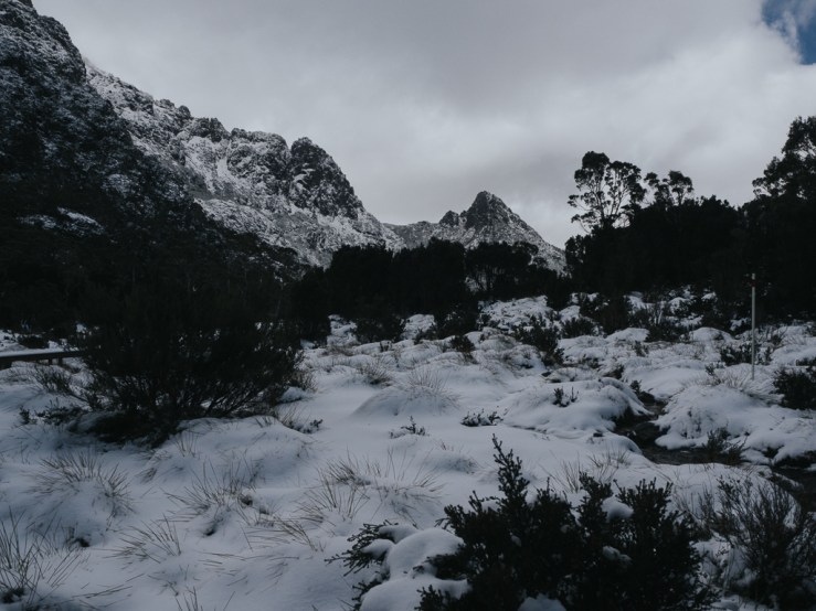
We got an early start on day 1 with Overland Track Transport collecting us at our hostel in Launceston just before 7am. We arrived at the Cradle Mountain PWS office, collected our park permits, and were off on the trail around 10:30am. The forecast was poor but when we started, the skies were blue and we thought that maybe the weather wouldn’t be so bad after all. That opinion quickly changed as we encountered rain, then hail, then snow within the first hour (although not before we had the chance to spot a very cute and furry wombat trundling alongside the trail). Still, we were well-ready for any type of precipitation with waterproof overpants and jackets, so we continued on.

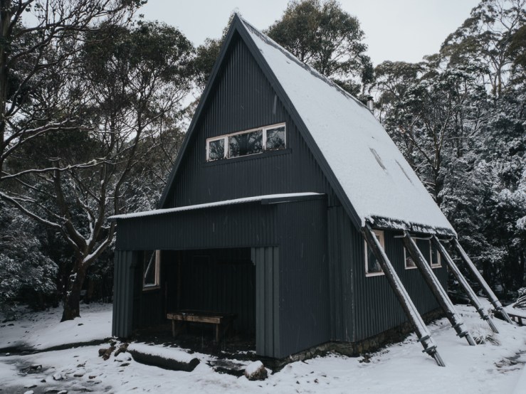
Steve even made it to the summit of Cradle Mountain (I followed most of the way up but I wasn’t a big fan of the boulder scrambling so I got a good view and then headed back down). While I waited for him at Kitchen Hut, an old hut and day shelter spot near the Cradle Mountain summit trail, I met Paul, one of the rangers for the area. By the time Steve returned from the summit, the snow was coming down thick and fast, so we figured we’d better get a move on to our first hut. Going over the ridge got more and more difficult by the minute with the heavy snowfall, and we were happy to see the turn off down to Scott Kilvert hut (the usual hut at Waterfall Valley is under renovation).

We arrived to Scott Kilvert early in the evening and almost everyone else was already there. A few more straggled in after us, making 10 in total. Two couples, a father and son duo, and four solo walkers. While there was a bit of chatter between the groups, we were all pretty much doing our own thing, although everyone gathered around when Steve managed to light the old coal stove that was the one source of heat in the large hut. However, over the next few days we would forge a bond as we battled against the weather together.
Day 2: Scott Kilvert hut to Scott Kilvert hut (~4km)

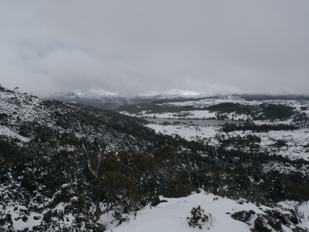
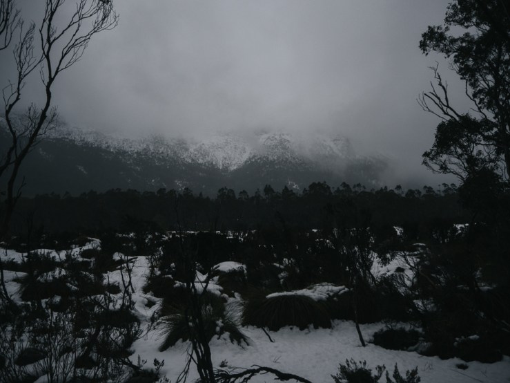
In the morning, it was obvious that the snow had not let up overnight. It coated the ground and was still coming down hard as we packed up to leave. We wondered what it would be like at the top, where there were no trees and only the wind whipping along the ridge… there was only one way to find out. About half of the folks in the hut started off around 8:30am and after about an hour and a half of climbing (oh yeah, the worst part of the move from Waterfall Valley to Scott Kilvert is that the replacement hut is down a massive slope 2km from the main trail) we reached the top to find that the winds were so strong we could barely stand and snow so deep one wrong foot placement could send you in up to your chest.
We had just barely started along the ridge when we were surprised to see someone coming toward. Surely nobody starting the track that day was already so far along as to be nearly at the hut, right? Indeed, we soon realised it was Paul, the ranger. “I can’t stop you from going on,” he was saying, “but I strongly recommend you don’t.” I think it took us all a minute to process what he meant. Turn back? But we’d just come up the massive hill! Still, we figured he knew what he was talking about and we headed back down below the treeline, where the wind was suppressed, to talk more and catch up with the rest of the group who had started after ours. the ranger suggested we go back to the hut, he would inform us of the conditions and our options, and we could chat more. So that’s what we did.

Back at Scott Kilvert hut (hello again), the ranger said that the conditions were about as bad as he had ever seen them and had he not known there was a group who were going to attempt to make their way forward, he wouldn’t have left his own quarters at Waterfall Valley, but he wanted to warn and inform us. He told us the forecast (bad and getting worse), said that several people had already been rescued from the park after setting off their PLBs (personal locator beacons) the evening before, showed us the most exposed parts of our next few days should we decide to continue on, and gave us an alternate route out of the park if we decided to abandon our journey. We all decided to take his suggestion to wait it out for a day and see how things looked in the morning.
Day 3: Scott Kilvert hut to Lake Windermere (~12km)
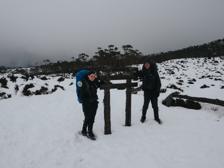
With the weather being what it was, we knew it would take us longer than usual to make it to the next hut (if we made it), so we got an early start. By 7:30 we were out the door and on our way up the steep incline from Scott Kilvert hut again. At the top, we could immediately tell that conditions were better. We could actually stand up straight! We could see ahead of us! Kind of… only as far as each next trail marker, but it was an improvement. After a brief stop at the emergency shelter sphere to discuss whether we were all game to continue on, we set forth.

Going across the ridge was like nothing I’ve ever experienced while hiking. Although it wasn’t quite as dramatic as crossing Awaroa Inlet in a thunderstorm, the weather alternated between a raging snowstorm and nearly calm and quiet. Every step we take came with it the risk of stepping off the narrow boardwalk (under at least a foot of snow) and ending up lodged in a drift until someone could pull you out or you unclipped your pack and rolled onto your feet. Still, it was an amazing experience. I certainly wouldn’t have ever deliberately planned to do this hike in these conditions, but I’m glad I got the chance.

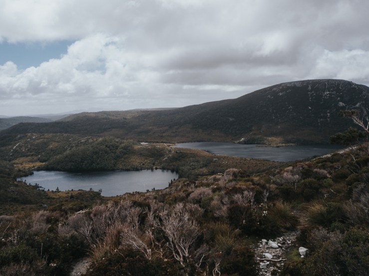
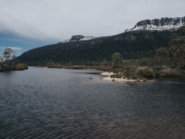
We reached Waterfall Valley just after 10am. The ranger had said he would be heading off himself around 10:30, so we figured he would catch up with us and indeed he did not too long after. We made a brief stop shortly before reaching Lake Windermere on top of a hill so that we could quickly take some photos and so that the ranger could get phone reception to check for messages from the Cradle Mountain office and the latest weather forecast (and the Arsenal score). Then we made our way down to the lake and the nearby Windermere hut. Another day done and we were back on our way down the Overland Track.

Day 4: Lake Windermere to Pelion (16.8km)

Windermere to Pelion is the longest day by a significant amount, with the usual estimate being 5-7 hours (and the ranger telling us it could take longer depending on the conditions) so once again it was an early start heading off just before 8am. The wind had died down significantly from the day before, however, and so hiking was much easier along the exposed areas. On the other hand, it had also begun to warm up slightly and so the rest of the trail was beginning to get slushy and worse, muddy. Still, going over mud was quicker than going over slow, and despite reaching the hut with wet boots we did get there much faster than we’d expected, arriving just over five hours after leaving Windermere. There we met ranger Melody and saw a couple of wallabies and wombats, so all-in-all it wasn’t so bad.

Also at Pelion hut, we experienced what a fellow hiker, who had walked the Pacific Crest Trail last year, said was called Trail Magic. On the PCT, he said, you could sometimes come across a group of locals firing up a grill to make hamburgers for the hikers, or stumble upon a cooler full of ice cold sodas labeled “FOR HIKERS!” Our own version of trail magic came in the form of a group of hikers who had hiked in via Arm River (a much shorter walk that gets you to Pelion hut in a day) with the intention of climbing some of the local mounts. Of course, with the weather being what it was, that was off the table, so instead they’d spent their trip chatting, relaxing, and drinking a ridiculous amount of port. They were heading out the following day, so they dropped a couple of leftover port-filled water bottles on our table and we reveled in the treat.
Day 5: Pelion to Windy Ridge (18.2km)

In the morning, it was clear that the weather was on the upswing. Much of the snow had melted off the boardwalk directly outside of the hut, and we could see some of the mountains in the distance. We even saw a rainbow! With the day’s portion of the hike only half the distance of the previous one’s, many people in our group were planning to take it easy and leave around lunch time for Kia Ora hut. However, Steve and I wanted to get back on track with our original schedule, which had us leaving the track on day 6. Note here: the usual track plan takes 6 days, and we had intended to do it in 5 with an extra day for side trips like Mount Ossa (the highest peak in Tasmania). This would mean that we had to double up and do two sections of the track in a single day. Our day in Scott Kilvert hut replaced any potential side trips, but we still had to skip a hut if we wanted to keep to our Monday departure, so we said goodbye to most of our group, left early with a few others, and headed toward Kia Ora hut.
Going over Pelion gap was less difficult than the exposed ridges of the previous days; we were lucky that there was very little wind, judging by the experiences of some other hikers we met who talked about the horrible conditions as they crossed over the plain. We still had to pick our way through deep snow, sometimes stepping in puddles of mud almost up over our gaiters, but the worst of the storms had clearly passed. We reached Kia Ora hut around midday and stopped for lunch. Then it was time to say goodbye to the rest of the hikers who had been travelling alongside us up to that point, and Steve and I were on our own.
This portion of the track was, in my opinion, the worst, even moreso than the snow and wind. It was beautiful, yes, but the lower altitude and warmer weather led to a ridiculous amount of snowmelt. Many of the paths on the overland track are streams due to their construction, with water running off around them and down the rocky slopes. The paths on this day were more like rivers, rushing around and over our boots, soaking our socks and our pants even with our waterproof layers. Note: merino socks are a must if you expect your feet to get wet; they may get wet, but they’ll stay warm unlike other fibers.

When we reached Bert Nichols hut at Windy Ridge, we saw that everyone who had stayed there the previous night had already moved on and nobody else had come from Kia Ora that day. And so, in the biggest hut, a sprawling multi-room mansion of a place with a clothes-drying area, three bedrooms, and a huge kitchen/eating space, Steve and I were on our own. It was quite peaceful, if cold.
Day 6: Windy Ridge to Cynthia bay via ferry (9km)
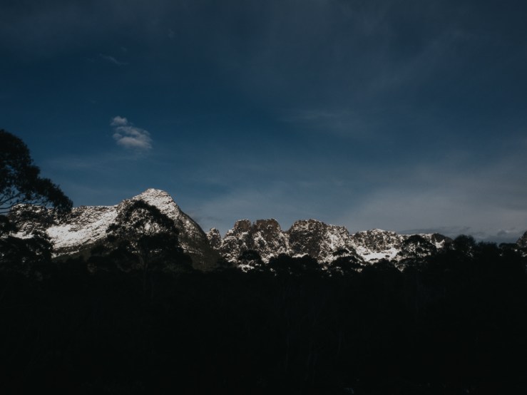
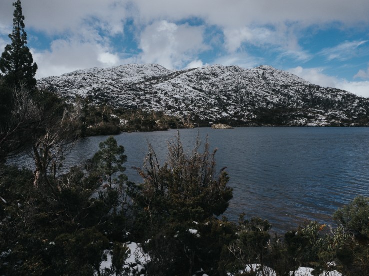
We started the next morning around 9am. Our ferry was booked for 1pm and we had only 9km to walk that day, so we didn’t need to be packs-on-and-out-the-door at 7:30 as we had other days, but we also didn’t want to miss the ferry! The snow was well and truly gone on this part of the trail. Although you could see it still covering the mountaintops, there was only a small patch here and there on the ground to remind us that only a few days before we had been up to our knees or even our waists! It was also warm—as we walked I took off my raincoat, my hat, and my buff, leaving just my merino shirt (although I did keep on my waterproof pants, not wanting to get caught out if it did start to rain again).

The ferry from Narcissus hut to Cynthia Bay and the end of the track has a minimum operation fee of $300 and Steve and I had a bad feeling that we would have to cover the costs as there was clearly nobody else arriving with us (unless some intrepid folks had decided to do a double from Kia Ora to Narcissus and somehow arrive by 1pm), but as we arrived to Narcissus we were delighted to see four other hikers relaxing on the porch. They had arrived the day before from Windy Ridge but had stayed through the night and spent a chilled day with plans to catch the ferry at 1pm as well! I went into the hut, radioed to reconfirm our booking, and then we all headed down to the jetty for our boat out. On the ferry, we watched as the mountains and lake flew by and then before we knew it we were at the Lake St. Clair visitor centre and our journey was over.
Walking the Overland Track was so much more than I could have imagined. Although I wish we’d had more time to walk from Narcissus back to Cynthia Bay rather than taking the ferry, and of course I wish we’d had better weather so we could’ve done some of the side trips and not been stuck in the hut, it was a hiking experience I will never forget, in some of the world’s most beautiful (albeit snow-covered) scenery.


This is a great story. I’m starting to plan my trip but I’m from Far North Qld so the idea of snow in November (or any time) is a little daunting for me.
That was a great read, thank you so much. I can’t imagine doing the track in the snow. It was tough enough in the rain! My husband and I plus two good friends did The Overland track in March 19-24, 2020. In fact we walked in on March 19th, unaware the borders started closing for Coronavirus and walked out to a very different world (after no internet for a week). We had alot of rain and wind particularly on the day from Scot Kilvert to Lake Windermere, which was challenging but it also cleared up for us towards the end. What an amazing walk and experience. Thanks for sharing