Moving to another country is never easy, and even more so during a pandemic. I’m still trying to get my residency card, set up a bank account, etc. etc. And job-hunting during a pandemic, in a small town known mostly for tourism? Nightmare. At least while I’m in the midst of getting all the logistics sorted out and sending an endless stream of CVs, I’m lucky enough to live in one of the most beautiful places ever. There’s a reason that Co. Kerry is known as The Kingdom. And the magnificent weather over the last week has offered ample opportunity to explore it with beautiful local hikes. I’m writing about them here in order of easiest to most difficult:
Torc Mountain
Torc is the easiest of the four hikes I went on this past week. Steve and I cycled into Killarney National Park and left our bikes at the base of the trail. I was surprised to see that there’s no official bike parking, but everyone else had locked their bikes to a nearby fence so it seemed fine. If you’re not arriving by bike, there’s also a decent amount of parking at two carparks, you can walk through the national park, or you can organise to travel by cab or horse and cart.
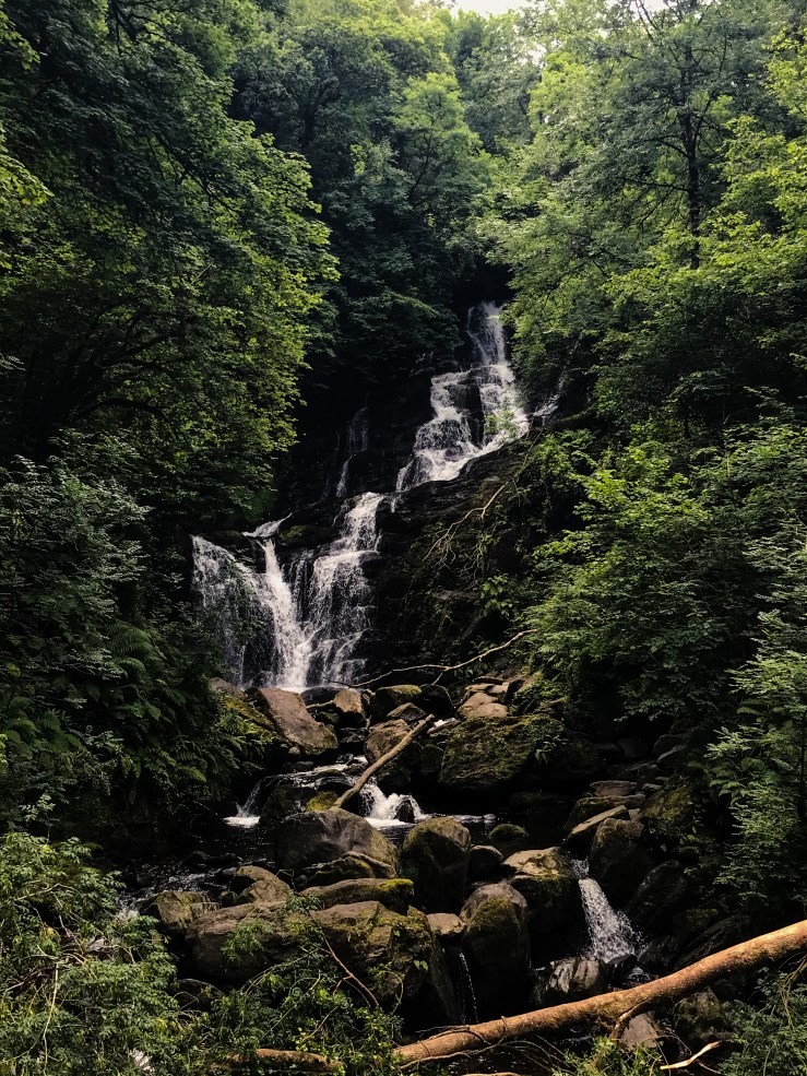
The start of the walk takes you up past Torc Waterfall, one of the most famous attractions in the park. Torc mountain and waterfall get their name from the Irish for boar because in Irish mythology Fionn mac Cumhaill was said to have killed a wild boar on the mountain with his magic spear.
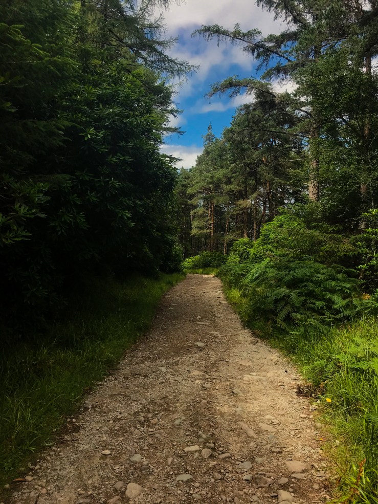
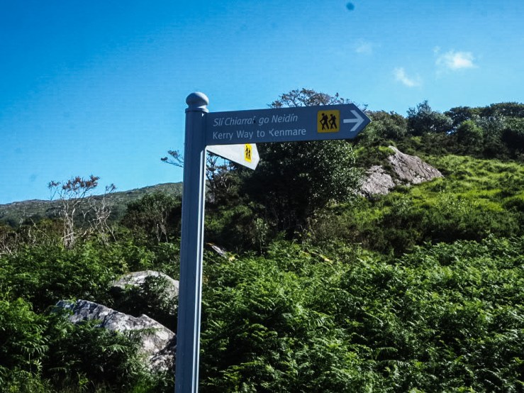
After you pass the waterfall, it’s a staircase climb (you can avoid this by parking at the upper carpark, but then you miss out on the waterfall) to the Kerry Way. This 214-km route loops Co. Kerry and starts and ends in Killarney, but to get to Torc you quickly turn off it at signs directing you up the mountain. From here, you follow a well-marked, boardwalk path up Torc to the 535m summit. It took us just over an hour.
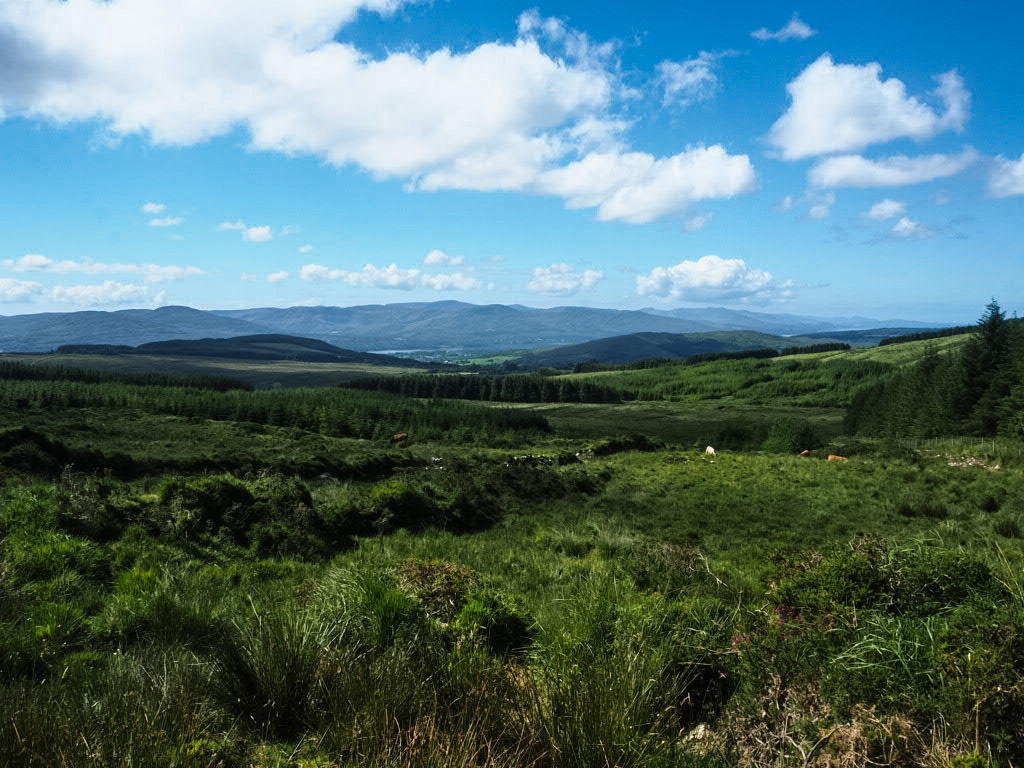
At the top, you’re treated to beautiful views of the lakes of Killarney, the national park, and the town below. The walk is definitely not strenuous thanks to the boardwalks which keep the path from getting too mucky, and it’s short enough that you can easily spend the rest of the day enjoying the park or Killarney town. If you’re keen for a more strenuous hike around the same area, the Cardiac Hill steps take you up the other side of Torc (although not to the summit) and, as the name implies, it’s a workout.

Old Kenmare Road
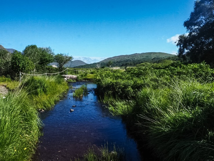
The Old Kenmare Road hike is difficult only in its length (16km) and the lack of shade for 90% of the walk. On an overcast day, you won’t have to worry about that, but we went on a beautiful sunny day and so it was a bit tiring to be out in the full sun for nearly all of the walk. However, it was well worth it to walk this path, part of the aforementioned Kerry Way. Beginning at the upper carpark of Torc waterfall, we followed the route past the Torc Mountain trailhead and through Esknamucky Glen. On one side of us was Torc Mountain; on the other, Mangerton.
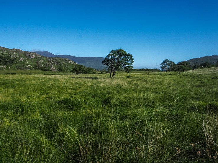
We went up and down gently rolling hills, with only a few steeper inclines (I recommend walking it from Killarney to Kenmare rather than the other direction, as it seemed much easier). We walked through some forested areas, some fields, past waterfalls and large boulders. Carved into a sheet of rock we passed along the way was the name of someone who had walked the trail some hundred years ago.
We stopped on Windy Gap for lunch. This 330m point is the highest on the walk. After that, it was a downhill descent with views of Kenmare bay in the distance. We reached the road and continued on another forty minutes or so before we arrived in the town of Kenmare. We went on a Sunday morning and the walk was fairly busy, with many people taking advantage of the beautiful weather.

The most difficult thing about this walk, logistically, is that it is a one-way route (unless you’d like to turn 16km into 32 and walk back, which would be doable as long as you have the time). Luckily, my friend’s parents were kind enough to drop a car to the end for us, but if you can’t do a car shuffle you’ll need to arrange for a lift back or make sure your walk coincides with the bus timetables.
Mangerton Mountain
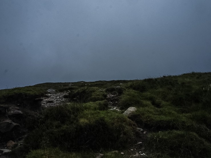
I had been up Mangerton the last time I was in Killarney, but it was October and the weather was bad, so we could hardly see anything from the top. It was a pretty decent day when we went this time, only partly cloudy, so we figured we’d have a better chance at getting some good views. Wrong. It was our bad luck that the sky clouded over and it began to gust and rain as we reached the summit (838m) and of course as soon as we started to descend it cleared up again. It can be up to 10C colder at the top than at the base, so definitely bring layers if you’re doing the trek.
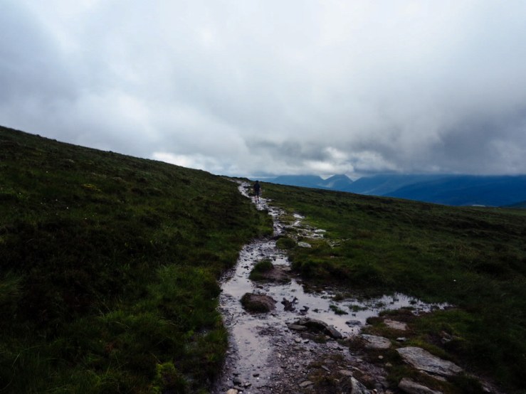
You’ll also definitely want old clothes, good (as in sturdy, not as in fancy) shoes, and if you’re arriving in a rental car I recommend packing some towels since it gets extremely mucky if there’s been any rain in the last few days. I ended up knee deep in mud because I stepped in what I thought was an ankle-deep puddle and my foot just kept sinking.
The start of the hike is well away from the center of town so you need to either drive or arrange for a drop-off and lift back. If you take a cab, make sure to get their number so you can call them to collect you, as it’s down a farm road and there won’t be traffic going past. Also, like many hike in Ireland, you cross some farmers’ fields, so be respectful. Don’t bring your dog, stay on the path as much as possible, and leave the sheep alone.
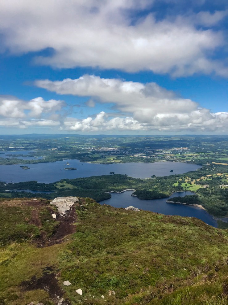
The walk up isn’t signposted but it’s fairly obvious where the path is. On your way, you’ll get to see the Horses Glen and the Devil’s Punchbowl, and from the top, MacGillycuddy Reeks, the Killarney lakes, and the national park. If the weather’s clearer than it was when we went, anyway. The hike will take 3-5 hours depending on how fast you walk and how long you stay at the top.

The northern slopes were the site of a battle in 1262 between the Mac Cárthaigh (Irish) and FitzGeralds (Normans). The area is known as Tuairín Cormac after a Gaelic chief who was killed in the fighting. If you’re looking for a hike that’s not as busy as Torc or the Old Kenmare Road, this is definitely the one. We only encountered four others doing the walk while we were up there, a nice and quiet spot in an otherwise busy town.

Carrauntoohil
Carrauntoolhil is the tallest mountain in Ireland, and deserves its own post. Stay tuned!
