
Note: Hi, hello, sorry, it’s been a while. I’ve been blogging 2-3x per week for work and writing some of my own personal projects, and it hasn’t left a lot of time for updating this. Apologies, I’m trying to work it into the schedule going forward.
Over the St. Patrick’s Day bank holiday weekend, Steve and I took a trip up to Donegal, which may be the only county in Ireland that can rival Kerry for beauty. From the rugged cliffs of Sliabh Liag to the lovely bike trail that runs along the lake in Glenveagh National Park, it’s a stunning and off-the-beaten-track part of Ireland that is well worth a visit.
Hiking Mount Errigal was one of our main goals in visiting Donegal, and we were lucky to have absolutely fantastic weather throughout the whole weekend. The highest point in the country, Errigal stands at 751 metres (although the trailhead starts fairly high up so your actual ascent is only about two-thirds of that) and has great prominence, making it a short but impressive hike to undertake.
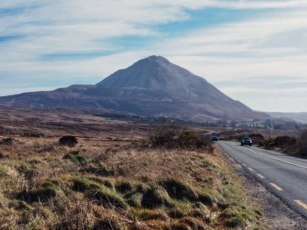
To get to Mount Errigal you take the R251 between Gweedore and Letterkenny, and as you approach the mountain you’ll get a great view of it on the horizon. The carpark is very small (although there’s another carpark not far away — with a coffee cart, great for a post-hike drink and snack) and many people park along the road.
The first portion of the hike doesn’t have a clear path, you simply make your way across an incredibly boggy field (good, waterproof hiking boots are highly recommended) however you see fit. Once you reach the real base of the mountain, the path is more obvious — and more difficult.

The trail is basically scree the whole way up. If you’ve hiked Carrauntoohil, it’s similar to the segment from the top of the Devil’s Ladder to the summit. It’s also fairly steep, ascending some 500 metres over the course of only a kilometre or so.
Given the short length of the hike (just over 4.5km) and the relatively low elevation gain, Errigal was a much more difficult trek than I expected. While I would still only class it as a moderate hike, it was definitely one where you had to have your wits about you, as there were a number of very narrow sections and the wind was strong even on a clear day with otherwise good conditions.
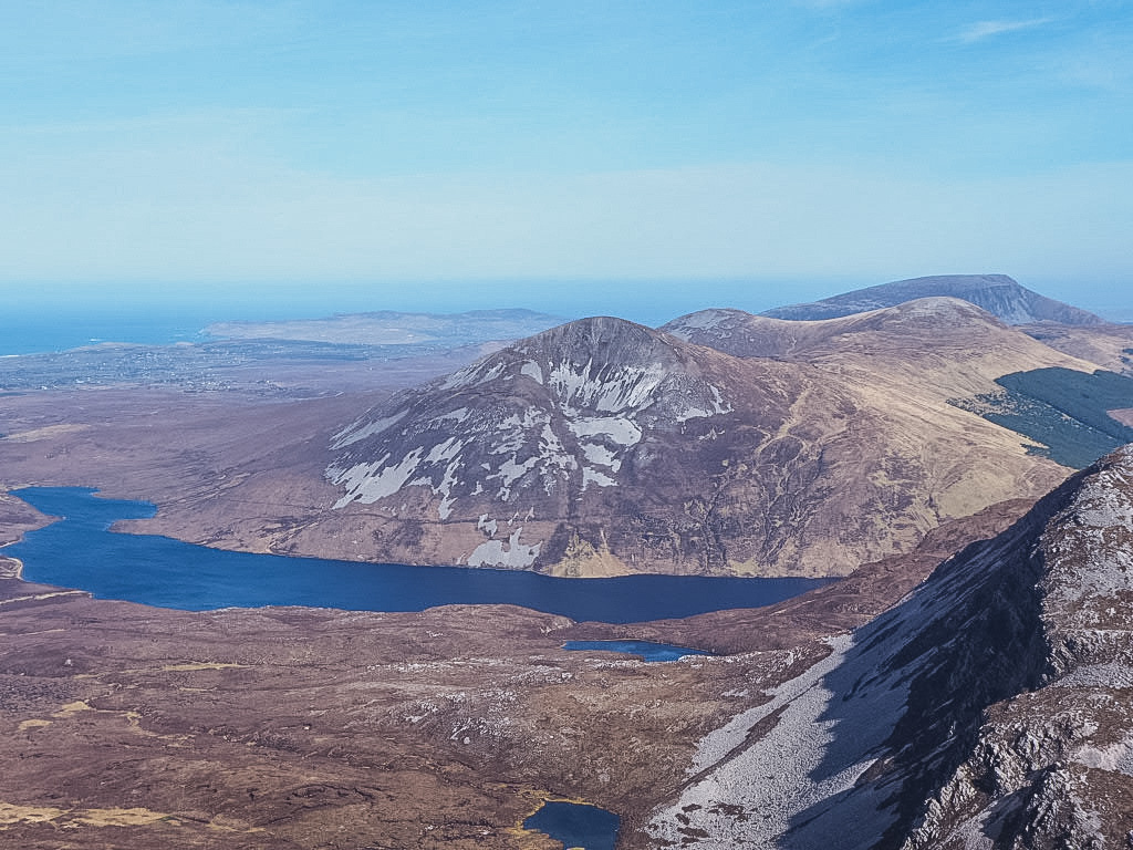
We reached the summit and didn’t linger as there were a few people at the top and the peak had only a small area to stand, but we did spend a few minutes enjoying the views across the Derryveagh mountains. There’s a second, slightly smaller peak about 30 metres past the true summit, but I was feeling a bit of vertigo so I didn’t cross the narrow passage between them.
Coming back down follows the same path for the most part. We went up on the east side of the stream that runs along the side of the mountain and came down the west side, and I’d say that the west side was much easier; you’re picking your way through more bush, but it’s much drier and less marshy.

One of the nice things about Donegal is that it is so remote compared to many other counties in Ireland, that even on a busy day the tourist sites are not overly crowded. I would guess there were about 30 people hiking Errigal at the same time as us, even midday on a beautiful and sunny bank holiday weekend. If I was hiking up a popular Kerry mountain such as Torc on an overcast, non-holiday weekend and only encountered 30 folks, I would consider it a very quiet day.
After finishing the hike in just under 2 hours, we stopped back at the aforementioned coffee cart — where the proprietor had such a strong Donegal accent I didn’t even realise at first that he had said ‘go raibh maith agat‘ (‘thank you’ in Irish) to me; I just assumed I couldn’t understand his accent. Then it was onto nearby Glenveagh national park and to continue our trip through gorgeous Donegal.
